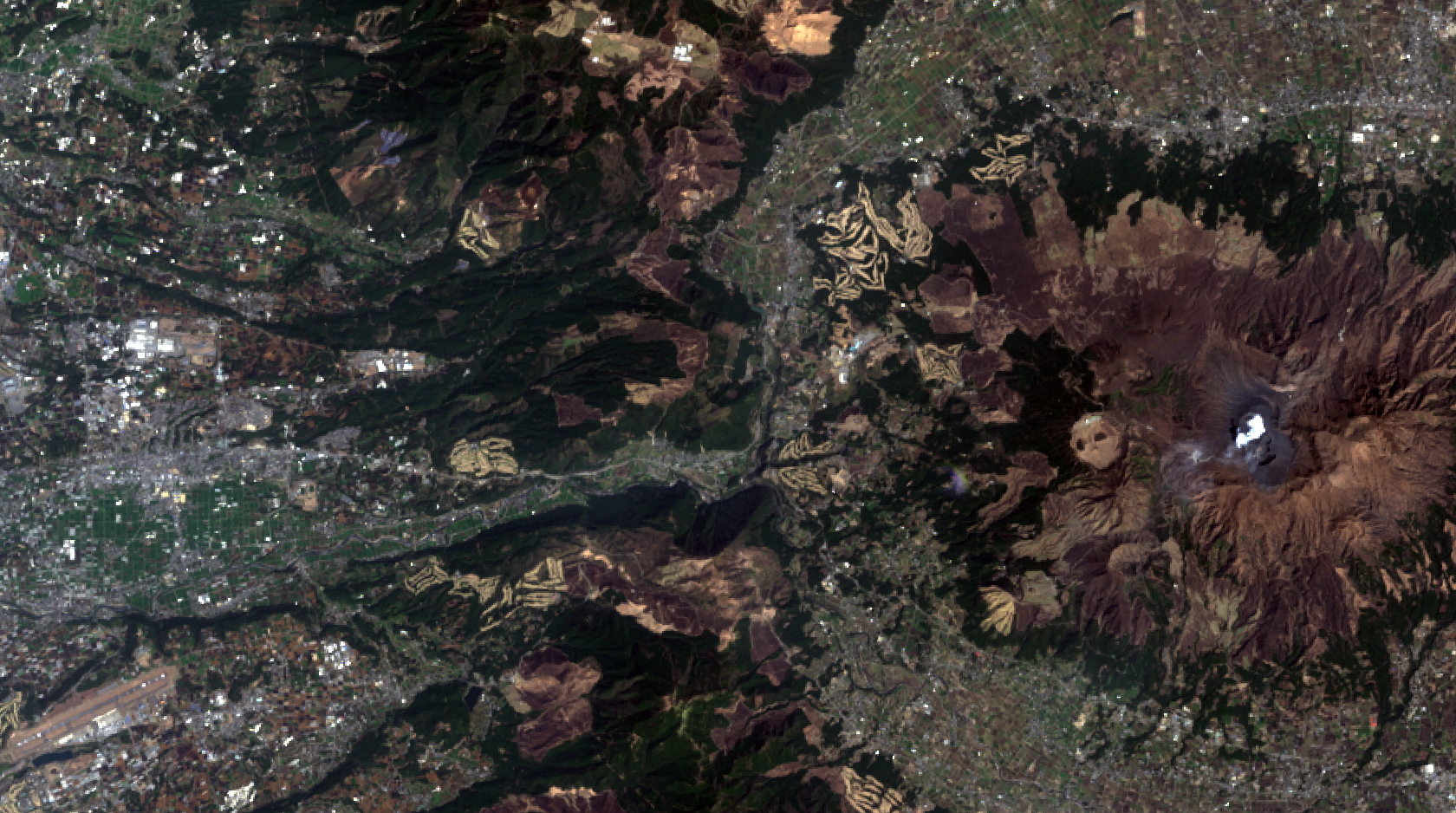
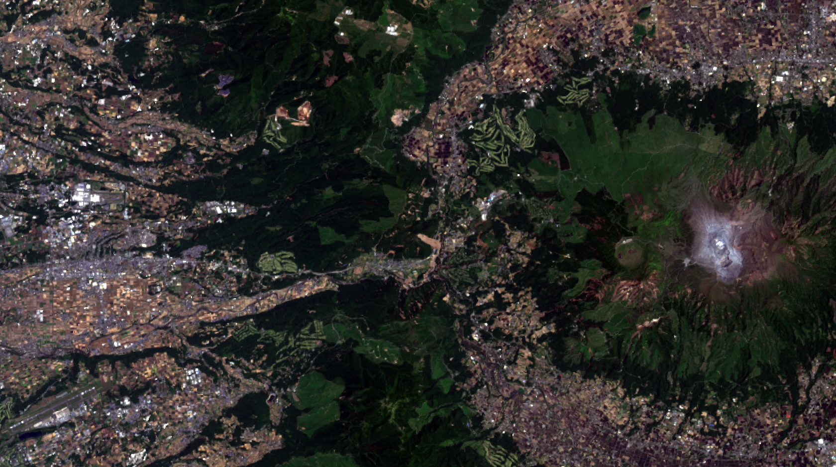
Landslides caused by Kumamoto Earthquakes at Tateno
2016年4月14-16日 熊本地震による立野地区の土砂崩れ跡
|
|
|
|
|
|
 |
 |
********** Large Earthquakes **********
|
|
|
|
|
|
 |
 |
---
|
|
|
|
|
|
 |
 |
The source data were downloaded from AIST's LandBrowser,
(http://landbrowser.geogrid.org/landbrowser/index.html).
Landsat 7/8 data courtesy of the U.S. Geological Survey.
Data process using RSP.
Kumamoto Earthquakes 2016
Fore shock: M6.5 at 21:26 JST on April 14.
Main shock: M7.3 at 01:25 JST on April 16.
熊本地震関連情報
平成28年熊本地震に関する情報 国土地理院
http://www.gsi.go.jp/BOUSAI/H27-kumamoto-earthquake-index.html
平成28年熊本地震に伴い発生した土砂災害の立体図(阿蘇大橋周辺) 国土地理院地理空間情報部
http://maps.gsi.go.jp/3d/gallery/20160414kumamoto/asooohashi/index_webgl_map.html
阿蘇大橋周辺の被害地図 | 特集 熊本地震:朝日新聞デジタル
http://www.asahi.com/special/kumamoto-earthquake/3d/
震度データベース検索 気象庁
http://www.data.jma.go.jp/svd/eqdb/data/shindo/index.php